


Q&A | Environment
How a new marine tracking system could help reduce whale collisions
In just three years, 37 cases of whales colliding with ships were recorded off the US east coast alone. Could a new, smart sensor-based marine tracking system, developed by a research team at the University of California, Santa Barbara, help shippers avoid accidents? Ross Davies meets project director Morgan Visalli to find out more.
Image courtesy of
Commercial whaling
may well have been banned for the last 33 years, but some might question whether the threat posed to cetaceans ever truly went away.
Earlier this year, Japan incurred the wrath of much of the international community when it decided to withdraw from the International Whaling Commission – the international body that since 1986 has been tasked with whale conservation – and resume hunting whales for profit. Both Norway and Iceland have also continued to flout IWC guidelines, and are reported to kill hundreds of whales each year.
In some cases, however, the demise of whales at the hands of humans is altogether less intentional – although no less shocking. According to the National Oceanic and Atmospheric Administration (NOAA), around 37 whales collided with shipping vessels off the US west coast between 2014 and 2017.
A recent study by Point Blue Conservation, a California-based NGO, suggests the situation might be even worse for the marine mammals, estimating vessel strikes are now responsible for more than 80 whale fatalities off the west coast each year. These include blue, fin and humpback whales – long understood to be endangered species.
For the past two years, a team of marine biologists and technologists at the University of California, Santa Barbara (UCSB) have been looking into how smart sensor technology might be harnessed to reduce the rate of collision between whales and ships.
Having secured funding from the Benioff Ocean Initiative (BOI) – a non-profit that belongs to UCSB – the team of scientists is working in collaboration with the NOAA to develop a new tracking system based around the use of sensors and real-time hydrophones (essentially underwater microphones), able to capture whale calls.
The hope is that the reams of algorithmic data collected from this system will allow ships to forecast the movement of whales across their routes and, in turn, ensure they steer clear of feeding grounds.
As Morgan Visalli, from the BOI, and one of the project’s directors, explains below, the plan is to commercially launch the technology in the shipping lane leading to the Port of Los Angeles early next year. More encouraging still, shippers appear to be behind the project.

Morgan Visalli, research team director at University of California.
Image courtesy of
Ross Davies:
Just how serious is the threat posed to endangered whale species off the US west coast?
Morgan Visalli: Whale populations have been hunted to extinction over the past 200-300 years. While commercial whaling may have largely dropped off in a lot of places around the world, one of the main threats to the recovery of species remains vessel strikes.
This is a big problem off the coast of California, especially in regions near the ports where there is a high concentration of vessels overlapping with important breeding grounds and migration routes for endangered whale species. As a recent study showed, around 80 whales – blue, fin and humpback – are killed off the west coast each year.
How did the project come about?
The Benioff Ocean Initiative is an applied research centre within the University of California, Santa Barbara. Our job is to take the research that is coming out of different universities and academic institutions and help apply that to solve problems facing our oceans.
A lot of the work we do around these ocean issues is crowdsourced, so anyone can go onto our website and submit a problem in the ocean that they are looking for scientists and technologists to solve. We then put together coalitions of scientists to actually develop solutions and fund the ideas that they come up with.
As part of a crowdsourcing campaign back in 2017, we received a lot of submissions around marine mammal conservation with quite a few actually related to endangered whales. That was the inspiration for the project. It also made a lot of sense, as this is an area of concern right in our backyard in the Santa Barbara Channel, where there are a lot of vessels going to and from ports, coinciding with feeding grounds for humpbacks and fin whales.
How does the tracking system work? Is it mainly reliant on smart sensor technology?
Yes, although I’d say there are a couple of different modalities that form part of the system. One of them is near real-time acoustic signalling, which is used underwater and listens for calling whales. Onboard, we are then able to run audio through the detection algorithm in near real-time to pull out humpback and fin whale calls and then send that information back – via a satellite link – to be verified by a technician.
This all happens really quickly, as it is automated and all the processing happens right onboard where the hydrophone is located out on the ocean. So we can get near real-time information from that acoustic system.
The technology behind the acoustic system was developed by Woods Hole Oceanographic Institution. This project has really been based around a lot of partnerships and collaborations.
Another interesting piece of the project is the predictive model for blue whale habitats, which is basically like weather forecasting, but for whales. This uses 3D real-time oceanographic data to predict where the whales are going to be in the future, based on current oceanographic conditions. This means we can get a really good sense of where these whales are likely to be feeding in our region, helping ships plan their journeys.
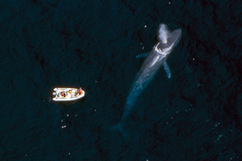
Image courtesy of
How far along is the project? Are you still on course to launch the technology at the Port of Los Angeles next year?
We’ve completed our research and development phase, in which we tested some of the different technologies and modalities. We’re now moving into the next phase of the project, where the focus will be on implementation. We’re still aiming to publicly launch the system in 2020.
What kind of reception has the project received from the shipping companies?
I don’t think anybody in the shipping industry ever wants to hit a whale. A lot of guys in the industry are ocean people and respect the rights of whales as much as the rest of us. So the reception so far has been positive. I think the general consensus is that the more information the better, and that having a better sense of where whales are can only help shippers increase awareness and help them respond in an effective way.


